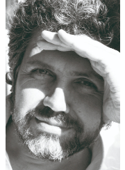
Xavier Pons received his BS in Biology in 1988, MS degrees in Botany and Geography in 1990 and 1995, and a PhD in Remote Sensing (RS) and Geographic Information Systems (GIS) in 1992 (UAB). His main work has been done in radiometric and geometric corrections of satellite imagery, cartography of land cover and ecological parameters from remote sensors and GIS development, both in terms of data structure, organization and international standards for geoservices, and in terms of software writing (MiraMon). He has also worked in forest fire hazards, implications of image data compression on RS and in analysis of landscape changes, water usage, snow coverage and droughts from long time series of satellite images. Dr. Pons is Full Professor at the Geography Department of the UAB and leads the research group GRUMETS, devoted to Geographical Information Science and composed by 20 people from the UAB, CREAF and EBD-CSIC. He won an ICREA Academia award in 2010 and in 2015.

Xavier Pons
ICREA Academia 2010 & 2015
Universitat Autònoma de Barcelona · Social & Behavioural Sciences

Research interests
1. Climate models based on geographical analysis and high resolution and global RS/GIS databases (Big Data), and their application to detect spatial patterns of drought at different time scales. 2. Robust methodologies for comprehensive RS processing (geometric, radiometric, classification), with particular emphasis on global data to improve knowledge of land cover dynamics. 3. To contribute to standards for geoservices in the context of GMES/Copernicus, GEOSS, etc. 4. To properly address the spatialization of the quality in geographic information. 5. To develop methods and experiments to adapt our radiometric correction models to diffuse‐only illumination situations and in areas of high latitude. 6. To continue working in the synergy between field radiometry, drones and satellite imagery
Keywords
GIS, Remote Sensing, Climatology, Geography, Environmental Sciences