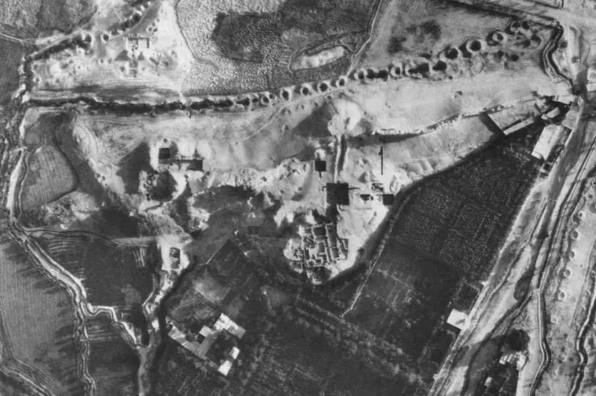
Ancient qanats—underground aqueducts up to 3,000 years old—once enabled human settlement in some of the world’s driest regions, stretching across North Africa, the Middle East and beyond. Despite their historical importance, many have been lost over time, and rediscovery has been hindered by the laborintensive nature of traditional field mapping and limitations in earlier detection methods.
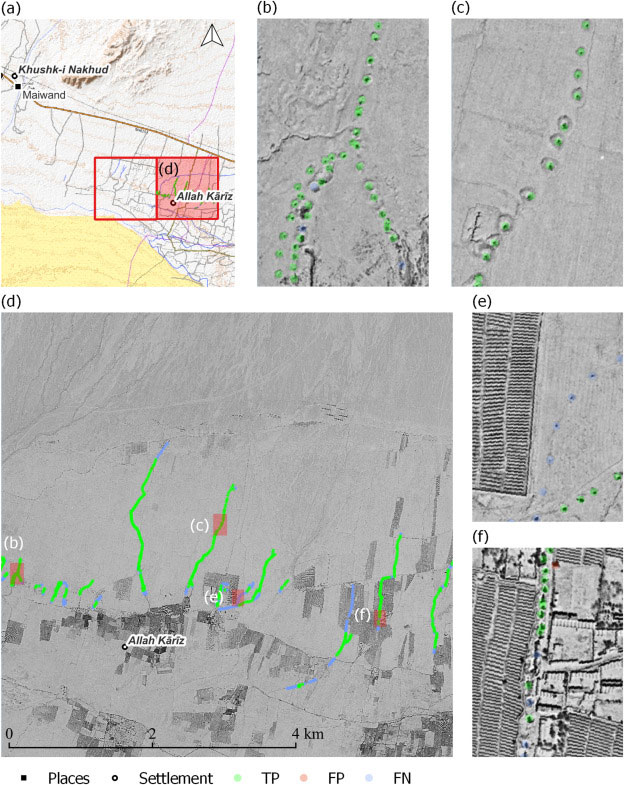
The presence of these remarkable hydraulic systems is marked by surfacevisible lines of regularly spaced shafts. Our team used Cold War-era HEXAGON spy satellite imagery and advanced AI models like YOLOv9 to automate the detection of qanat shafts across diverse landscapes. By training on real, augmented, and synthetic datasets, we achieved a detection precision of 0.881, significantly reducing false positives and overcoming the challenges of earlier approaches.
This innovative approach not only automates the rediscovery of qanats but also enhances the study of ancient water management systems, providing valuable insights into modern challenges like sustainable practices in extreme environments.